West Highlands, Ben Starav 5, East Glen Etive


West Highlands, Ben Starav 5, East Glen Etive
Scotland
🏕️ Wild Camp: Areas along hike and on summits
🚲 Bike and Hike: ❌
💧 Water Source: Near Start and Finish
🏊 Wild Swim: River just of Parking
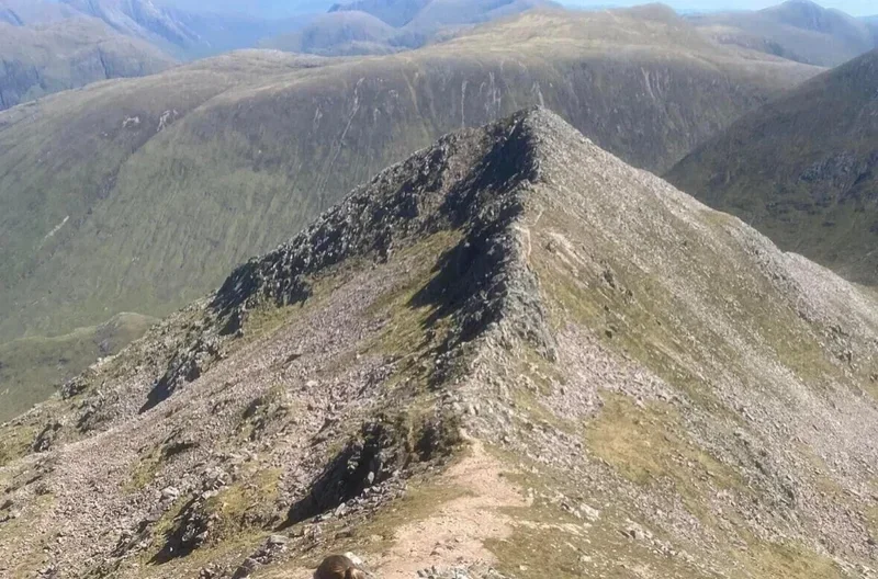
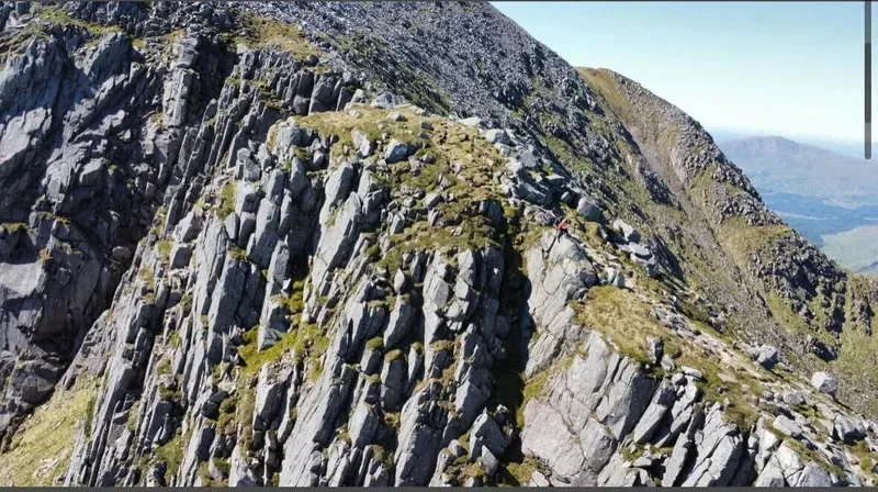
Ben Starav (1,078 m) dominates East Glen Etive in the West Highlands and the “Ben Starav 5” is a long, committing Munro round linking Ben Starav with Beinn nan Aighenan (960 m), Glas Bheinn Mhòr (997 m), Stob Coir’an Albannaich (1,044 m) and Meall nan Eun (928 m). Starting from Glen Etive (commonly near Coileitir), the circuit is around 24km (14 miles) with roughly 2,500 m of ascent and typically takes 10–14+ hours, making it a serious mountain day requiring strong fitness and solid navigation skills. Lower sections can be boggy, with steep, rocky climbs onto broad ridges and exposed high ground where wind and poor visibility can make route-finding complex, but in clear conditions the views over Loch Etive and the surrounding peaks are exceptional.
14.2 Miles, 10-16 hours
Beinn nan Aighenan, Glen Etive
Scotland
(Munro) Beinn nan Aighenan 960 meters
Lat, Long 56.52002, -5.012127
OS Grid Ref NN148405
10 miles 7-9 hours
bog***
hike***
deer stalking enquires 01855 851277, 07766 124596, glenkinglass@gmail.com
Stob Coir'an Albannaich and Meall nan Eun
Scotland
(Munro) Meall nan Eun 928 meters
Lat, Long 56.56121, -4.943775
OS Grid Ref NN192449
(Munro) Stob Coir' an Albannaich 1044 meters
Lat, Long 56.554935, -4.980722
OS Grid Ref NN169443
11 miles 7-9 hours
bog***
hike***
West Highlands, Ben Starav and Glas Bheinn Mhòr
Scotland
(Munro) Ben Starav 1078 meters
Lat, Long 56.538846, -5.051043
OS Grid Ref NN125427
(Munro) Glas Bheinn Mhor 997 meters
Lat, Long 56.541749, -5.005719
OS Grid Ref NN153429
10 miles 8-9 hours
bog**
hike***
deer stalking enquires 01855 851277, 07766 124596, glenkinglass@gmail.com
Submit Walkers Report
Mountain, Scottish, hill, munrobagging, munro weather, munro parking, distance, time.